| Reply to Thread New Thread |
 08-09-2012, 04:36 AM
|
#81 |
|
|
 > The pieces will likely stay on Mars. There are no plans to recover them to bring back to Earth. That is, unfortunately, true. The would be considered cultural heritage objects first and become tourist attractions later. I am dying to see some sample returns from Mars. "In 1970, the Soviet Union planned for a 1975 first Martian sample return mission in the Mars 5NM project". It's taking a long time. |

|


|
08-09-2012, 06:27 AM
|
#82 |
|
|
|
|
|
|
08-09-2012, 06:32 AM
|
#83 |
|
|
I am dying to see some sample returns from Mars. "In 1970, the Soviet Union planned for a 1975 first Martian sample return mission in the Mars 5NM project". It's taking a long time. Reform the USSR first? :-) |
|
|
|
08-09-2012, 06:35 AM
|
#84 |
|
|
|
|
|
|
08-09-2012, 06:45 AM
|
#85 |
|
|
|
|
|
|
08-09-2012, 09:53 AM
|
#86 |
|
|
|
|
|
|
08-09-2012, 12:33 PM
|
#87 |
|
|
Two more BW Hazmat images, same as the original first downloaded image but this time with dust cover removed, or so they say. Taken at different times of day. I note with a bit of horror that if a hazard avoidance camera is looking at the Sun then it can't see any detail of the surface of Mars.
http://lilspaceoddities.files.wordpr...74-43_full.jpg (946*710) http://lunarscience.nasa.gov/wp-cont...A15973-br2.jpg (1280*1280) This one hit the web 4 hrs ago. It's the proof that the main camera mast has deployed successfully. They'll be taking better quality images from now on. 
|
|
|
|
08-09-2012, 01:00 PM
|
#88 |
|
|
> Here's the first frame from the video showing the heat shield just after separation
Full size hi-res copy of that image is now available: http://www.nasa.gov/images/content/6...-full_full.jpg (2108*1533) Curiosity's Heat Shield in Detail This color full-resolution image showing the heat shield of NASA's Curiosity rover was obtained during descent to the surface of Mars on Aug. 5 PDT (Aug. 6 EDT). The image was obtained by the Mars Descent Imager instrument known as MARDI and shows the 15-foot (4.5-meter) diameter heat shield when it was about 50 feet (16 meters) from the spacecraft. This image shows the inside surface of the heat shield, with its protective multi-layered insulation. The bright patches are calibration targets for MARDI. Also seen in this image is the Mars Science Laboratory Entry, Descent, and Landing Instrument (MEDLI) hardware attached to the inside surface. At this range, the image has a spatial scale of 0.4 inches (1 cm) per pixel. It is the 36th MARDI image, obtained about three seconds after heat shield separation and about two and one-half minutes before touchdown. The original image from MARDI has been geometrically corrected to look flat.  The best place for finding new images from MSL Curiosity is https://twitter.com/MarsCuriosity Images appear there at least six hours before Google image search can find them. |
|
|
|
08-09-2012, 01:46 PM
|
#89 |
|
|
You saw it first here. These images from Curiosity have not yet appeared anywhere else on the web. I've screendumped them from NasaTV.
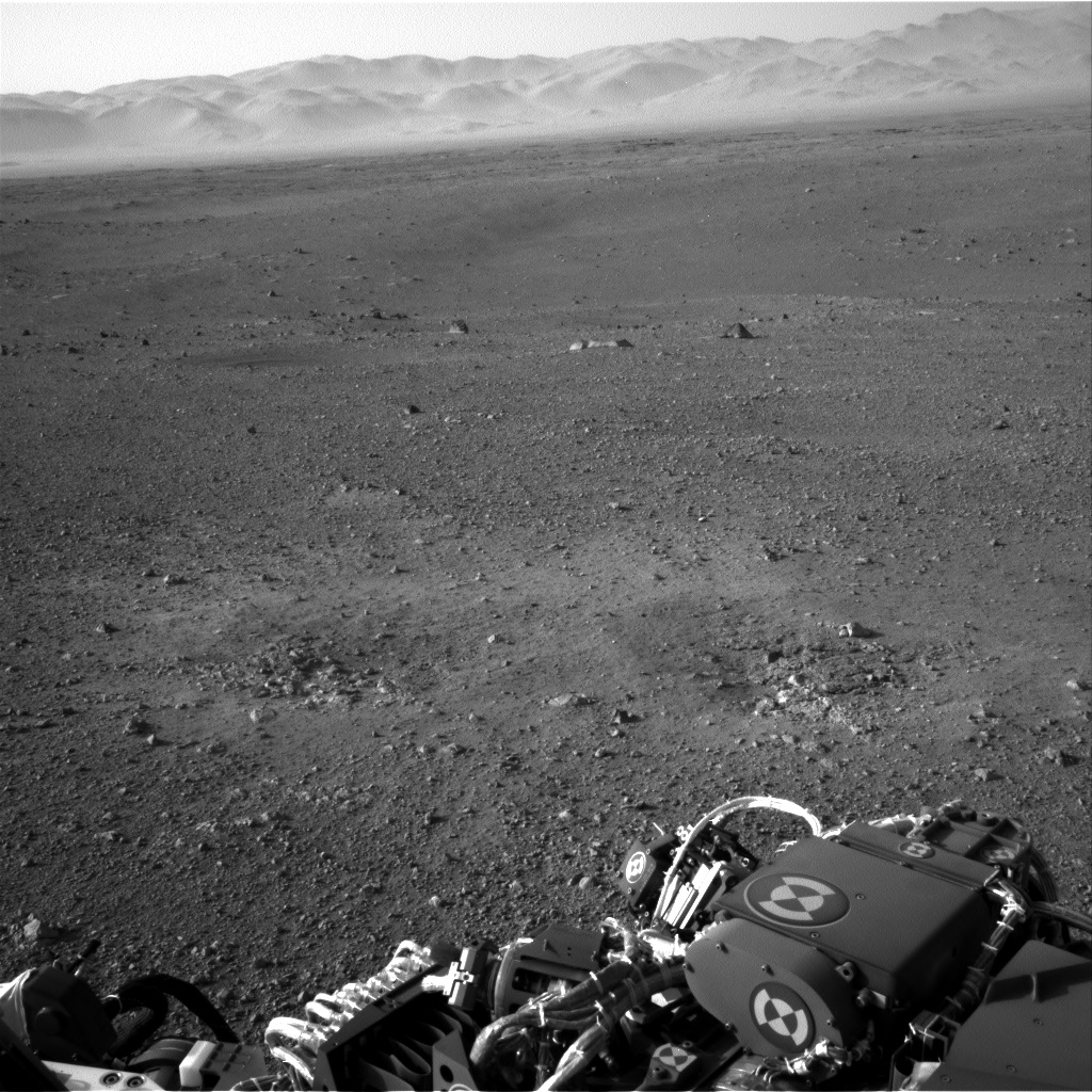
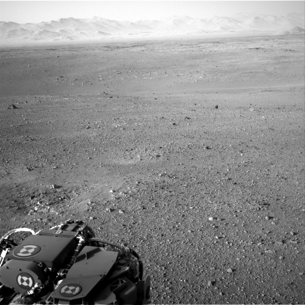
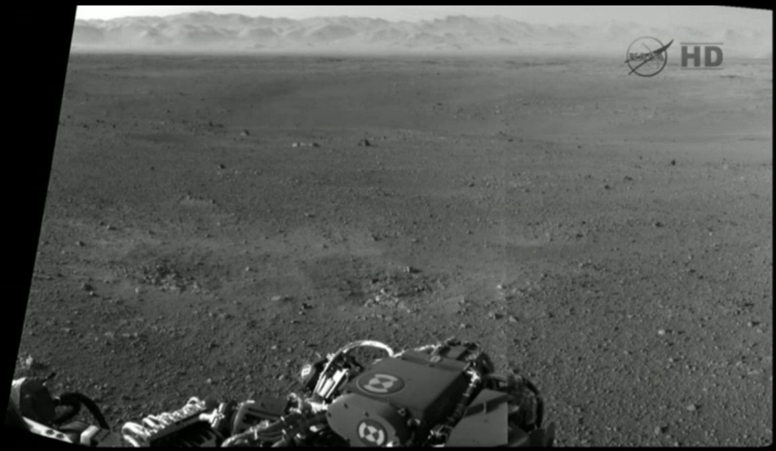 The above image looks remarkably Earth-like, perhaps because the geological processes are the same as on Earth. Several important features can be seen, such as small scarps in the distance on the flat, these will be worth investigating. 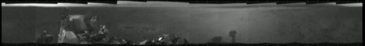 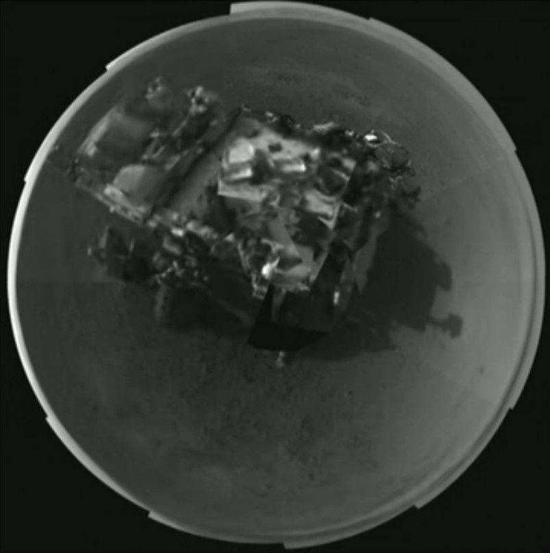 The above two are the same 360 degree panorama, just assembled in different ways. 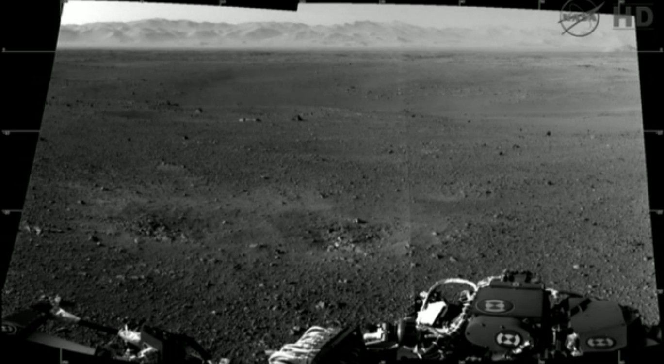 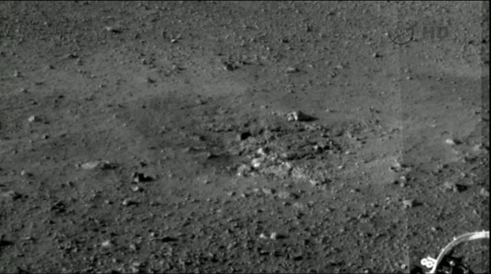 The above is a detail. This hole was created during landing and seems to be our first view of the bedrock. Not the crater floor but solid material created by deposition from erosion of Mt Sharp. 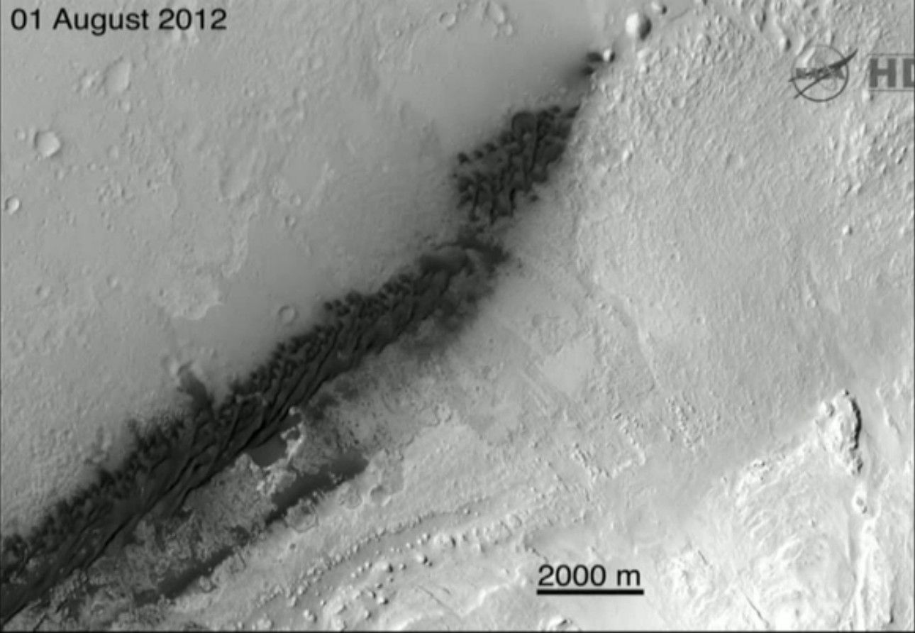 The above is an overview image with landing site at left. http://i120.photobucket.com/albums/o...Curiosity8.jpg Click on link for image. This is a detail from a re-photograph from Mars Odyssey of the right hand part of the image above it, 12 km downrange of the landing site. The black dots are pieces of the craft that fell ahead of the lander, scattered over a distance of about 1 km. 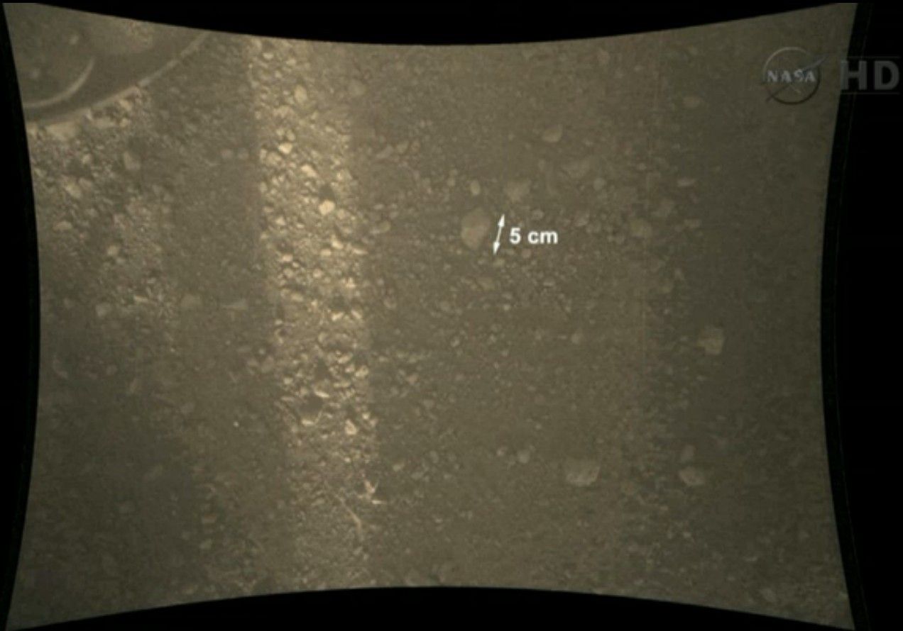 The MARDI image after landing. The view straight down, about a yard wide. From this and other images we know that there are no geological limitations on rover movement. The changes in soil colour are not reliable. 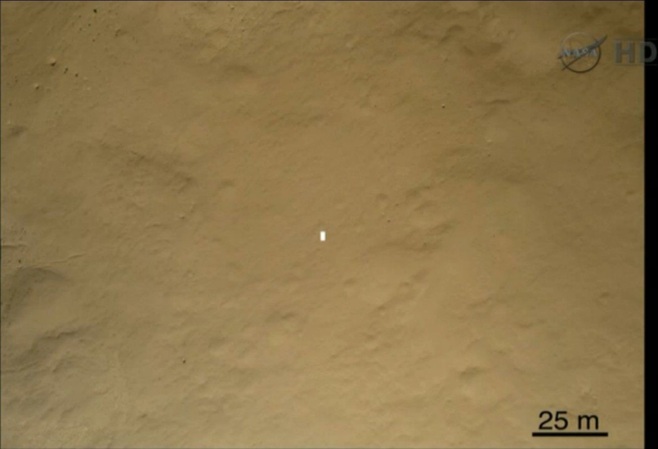 A MARDI image during descent. The white dot is the size that the rover would appear on this image after landing. There's an interesting high rock a short distance to the south west. http://i120.photobucket.com/albums/o...uriosity11.jpg Click on link from image. Preliminary radiation measurements from Curiosity. This has not yet been corrected for factors such as RTG radiation. The radiation environment on Mars is currently quiet except for a few heavy ion events. We're approaching the peak of the sunspot cycle so the Mars radiation measurements over the life of the mission are going to be very interesting. |
|
|
|
08-09-2012, 07:59 PM
|
#90 |
|
|
Image: Mars Curiosity rover caught in the act of landing by HiRISE 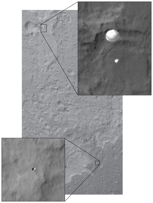 The same image also shows the heat shield tumbling away. |
|
|
|
08-09-2012, 09:36 PM
|
#91 |
|
|
By my count I already have 9 posts in this thread, and in most of the other threads on the MSL
Or didn't you notice them? |
|
|
|
08-10-2012, 12:56 AM
|
#92 |
|
|
Anyway in other news...
I'm looking for someone who wants 20 bucks. After proof is estalished of course. |
|
|
|
08-10-2012, 12:59 AM
|
#93 |
|
|
Proof of what?
I got proof of snake oils, Murray coils, bunyips, beasts and penny royals. I got proof of Martians, starshines, warships and silly rhymes. You say you need proof, I say I got proof. |
|
|
|
08-10-2012, 01:10 AM
|
#94 |
|
|
I say I got proof.
----------------- Do you have a photo of the lander from 20 feet away... |
|
|
|
08-10-2012, 01:15 AM
|
#95 |
|
|
|
|
|
|
08-10-2012, 01:27 AM
|
#96 |
|
|
Yes.
----- A little less conversation, a little more action please... All this aggravation ain't satisfactioning me |
|
|
|
08-10-2012, 01:41 PM
|
#97 |
|
|
More pictures. Not getting high resolution from the main "mast" cameras yet. The high gain antenna either has or shortly will be activated. Initial communication was at a low bit rate.
Pictures: Landing ellipse: http://twitpic.com/ahdtkg For detail on Quad 51 square see image later. Large panorama: http://www.nasa.gov/images/content/6...-full_full.jpg Although this seems big, it is only stitched together from 130 144*144 pixel thumbnails - we'll see images with much higher resolution than this later. Zooming in on landing site from Full Mars: http://www.youtube.com/watch?v=fojvp...2&feature=plcp Self portrait: http://www.nasa.gov/mission_pages/ms.../pia16027.html Note the large pebbles that have landed on the surface of the craft. This was totally unexpected. Images screen-captured from NASA TV 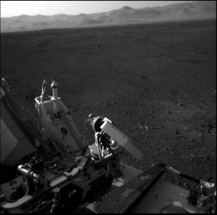 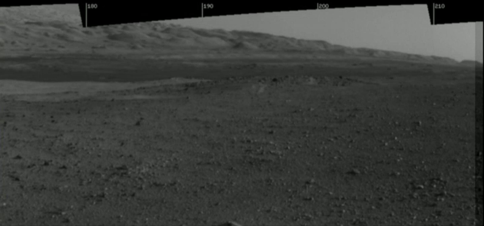 This is a zoom in on the direction in which Curiosity will be headed, it's known to contain layered geology. 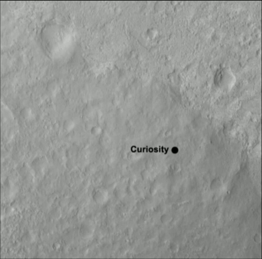 Quad 51. 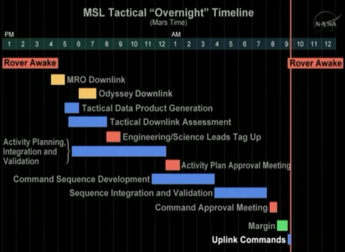 Shows what the MSL team at NASA is doing while the rover is asleep. 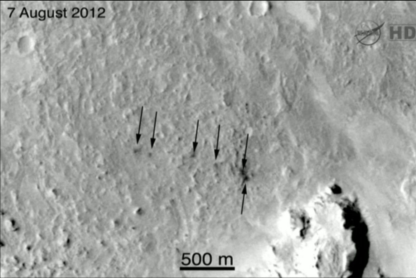 The black dots here are impact marks from ballast released from the lander just before the parachute deployed |
|
|
|
08-10-2012, 07:59 PM
|
#98 |
|
|
Sorry if these have already been posted, colour images from Mars.
http://www.abc.net.au/news/2012-08-1...images/4190376 |
|
|
|
08-11-2012, 08:06 AM
|
#99 |
|
|
|
|
|
|
08-11-2012, 11:26 AM
|
#100 |
|
|
I saw the 3am press conference.
No new images. This was a debriefing from the landing team. One old image is of the weather just prior to landing. None of the weather events was near Gale crater. For full size: http://www.nasa.gov/images/content/6...68-43_full.jpg  Some information on the landing: 1) The information from Curiousity arrives on Earth from via four different routes - direct + three Mars orbiting satellite relays. 2) So far, Curiosity has recorded 100 MB of data which remains in storage onboard. Only 1 MB of data has been sent back to Earth so far. 3) The computer on Curiosity 133 MHz, 4 GB storage, about 1/10 the speed and 1/16 of the storage of a mobile phone. 4) MSL entered the atmosphere at Mach 24, the six balance masses were ejected at Mach 20. 5) There were three course corrections (known as bank reversals) on the way down before parachute deployment. 6) There was a tailwind on landing. 7) This is the 11th parachute descent on Mars. 8) The parachute was deployed at Mach 1.7 9) The wobbling motion while under parachute is known as "wrist mode" 10) While under parachute the spacecraft rotated at between 1 and 2 degrees per second. 11) The heat shield had moved 15 metres away in the first 3 seconds. 12) Landing time differed by only 0.6 seconds from a prediction made three weeks earlier. 13) No errors reported so far, everything happened on schedule and was within the expected range. Apart from landing with more fuel than expected. 14) The rocks around the landing site are about 2.7 billion years old. 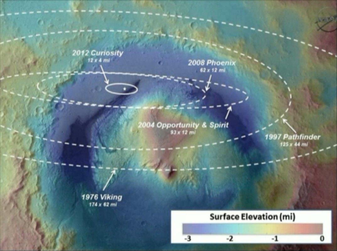 Landing ellipse of Curiosity compared with those of previous missions.  A Hazmat camera picked up what is believed to be the dust plume from the sky crane crash. The sky crane has crashed before the first image was taken. The later image was after the dust plume had settled. 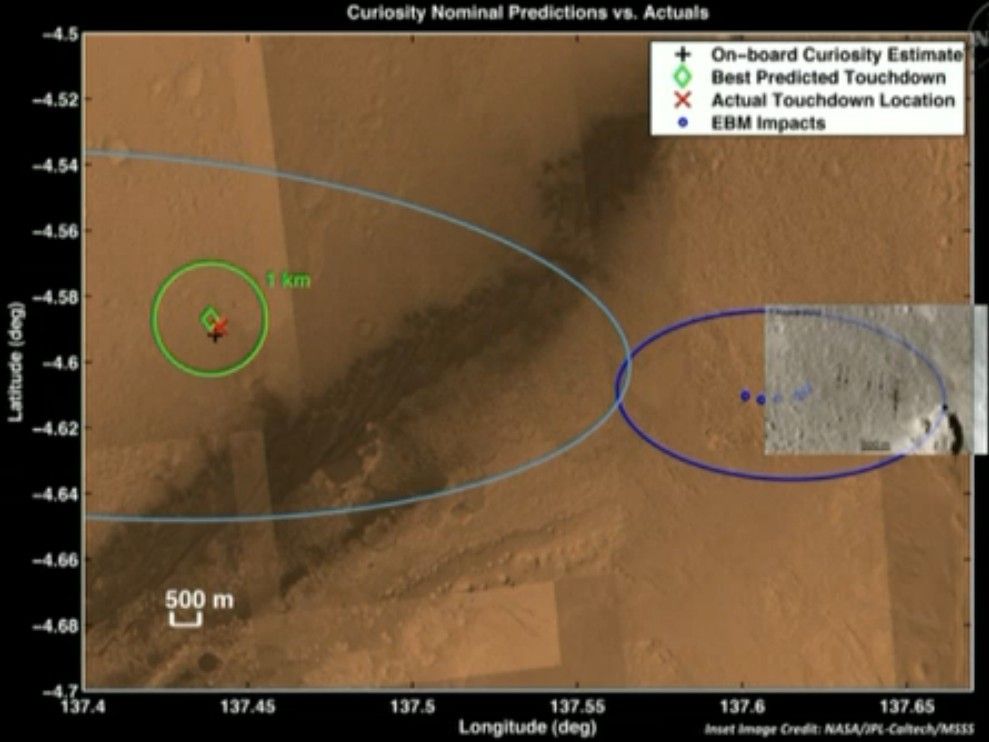 Landing sites observed (actual) vs those predicted from the EDL software. The next four days (Sols 5 to 8) are going to be spent downloading and installing revision 10 (R10) software. This software is being downloaded now rather than before launch because of limitations on computer storage on Curiosity. As an overview, the software for descent and landing is known as ESL and the software for operation on the ground is known as FSW. What is being done over the next four days is overwriting the ESL software with FSW software. Only basic FSW software was loaded prior to launch, software for taking photographs for example. All the software for operating the robotic arm, drill, sampling, driving and autonomous navigation has yet to be downloaded. While this software download, installation, backup and testing is underway we can't expect to see much if any new science from Curiosity. |
|
|
| Reply to Thread New Thread |
«
Previous Thread
|
Next Thread
»
 Linear Mode

| Currently Active Users Viewing This Thread: 3 (0 members and 3 guests) | |
|
|

